Ron Abramovich: Idaho’s snow man
Published 3:45 am Thursday, March 14, 2019
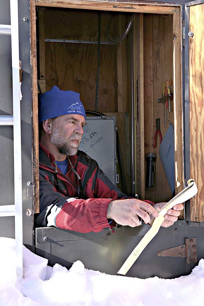
- Ron Abramovich, water supply specialist with the USDA NRCS Snow Survey in Boise, looks over recorded data at the SNOTEL Mores Creek data-collection site northeast of the city. The building’s multi-door design aims to eliminate the need to dig out an access.
- Idaho NRCS Snow Survey
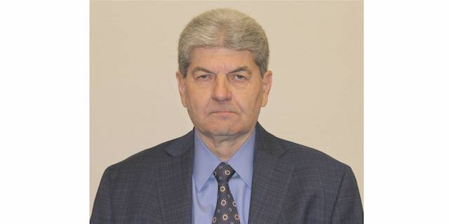
Idaho’s hydrology profession will have big snowshoes to fill at the end of April, when Ron Abramovich retires. The Boise-based USDA Natural Resources Conservation Service water-supply specialist and the state snow survey’s public face for decades would be the first to say the talent pool is deep. But even his fellow water scientists say he’s a giant in the field and will be missed. Abramovich, who each year delivers 30-plus public presentations and some 75 media interviews on how Idaho’s snowpack and expected streamflows are shaping up, has been a high-profile presence in the state’s agriculture community and beyond since the early 1990s.
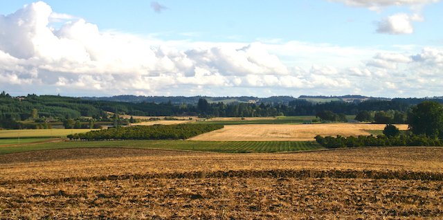
Farmers and their lenders use the snowpack information he and his NRCS colleagues compile to help inform planting decisions across Idaho, where 3.78 million acres of farmland are irrigated and water use for irrigation ranks second nationally, according to the U.S. Geological Survey. Each year, the Boise, Palisades, Minidoka and Owyhee reservoir systems in the Snake River Basin provide irrigation water for a combined $3.5 billion worth of crops and livestock.
“Ron has been a really key person for the state of Idaho,” said Troy Lindquist, National Weather Service senior hydrologist in Boise. “He is very knowledgeable, and has a wealth of experience and a great working relationship with a lot of people. He really knows his stuff. There is going to be a big hole to fill when Ron retires.”
University of Idaho agricultural economist Garth Taylor called Abramovich a “rock star” and “an institution in water.”
“There isn’t a person who doesn’t love Ron,” he said.
Because of irrigation’s importance to Idaho agriculture, when Abramovich talks, farmers and others listen.
“People are always interested in how the winter is shaping up,” Abramovich said. “Everyone wants the most current information. I have never given the same talk twice.”
Gauging water
Providers and aggregators of snow, weather and water data include NRCS and the Weather Service, USGS, the U.S. Bureau of Reclamation, the U.S. Army Corps of Engineers and the Idaho Department of Water Resources.
“There certainly is a lot of cooperation,” said the Weather Service’s Lindquist.
For example, the Weather Service and its Northwest River Forecast Center in Portland provide short-term streamflow forecasts.
The NRCS forecasts the water supply based on its monitoring of the mountain snowpacks. In the spring and summer, the snow will melt and supply water to the streams and rivers that fill the reservoirs across the state that in turn provide surface water to irrigators.
The Bureau of Reclamation and the Army Corps of Engineers use those forecasts to inform their decisions on the operation of their dams.
“We work with all of those agencies,” said Brandon Hobbs, Army Corps project manager and outreach coordinator in the Boise field office.
“The NRCS SNOTEL sites and data they provide in real time, and how it’s rolled up on a daily basis, provide the basis for the runoff forecasts that we use,” he said. “We use those for flood-control decisions, and we coordinate our forecasts and decisions with the Bureau of Reclamation.”
Abramovich said one valuable tool is the NRCS Surface Water Supply Index, which combines current reservoir storage with monthly streamflow forecasts to determine the water supplies in a basin. It also tells farmers when irrigation shortages will start.
Many farmers use the index to decide which crops to plant, choosing those that are less “thirsty” during years when water will be in short supply.
Another threshold, added in the past decade, identifies surpluses that could indicate increased flood risk or greater availability of water to recharge aquifers. Idaho has become a leader in recharging the aquifers that lie beneath the southern third of the state.
“It’s a very powerful index if you know how to use it,” Abramovich said.
Other popular NRCS reports include the monthly Idaho Water Supply Outlook, which is published January through June, and daily snowpack totals as a percentage of the long-term average.
Abramovich said that since he arrived at NRCS in Boise in 1991, the audience of primarily agricultural water users has expanded to include municipalities, power companies, fisheries managers, the outdoor-recreation industry and others.
He is a regular presenter at Idaho Water Users Association events, said Paul Arrington, the organization’s executive director and general counsel.
“He is a friend to the water users,” he said. “We can always rely on him for straightforward statements about what our water situation is going to be. If it’s going to be good, he will tell you. If it is going to be questionable, he will tell you.”
Abramovich said the straightforward presentation of current and historical facts, instead of speculation, has served him well. “We have a lot of data and complex information, but in my presentations I have learned to keep it simple.”
The volume, sophistication and usage of data have grown dramatically over the years.
Agricultural producers and a few others used the information in the early ‘80s, “but in the ‘90s, many more people were using it and understanding how it could be used in their decision-making,” Abramovich said.
For example, whitewater guides, over several wet and dangerous years in the late 1990s, asked NRCS to adapt the information to educate river runners about high-flow danger.
“The recreational community has learned how to use our information to look at when streams may peak,” said Abramovich, an avid rafter. That helps them increase safety by better matching conditions to skill levels.
SNOTEL units
To get its information, NRCS goes straight to the source — the mountains and valleys of Idaho — by using remote SNOTEL units and by measuring the snow depth by hand.
SNOTEL — short for snow telemetry — is an automated network for collecting and reporting local snowpack and weather data. Since NRCS set up the system in the early 1980s, the number of sites in the West has roughly doubled to about 850, including 82 in Idaho.
The remote units are set at varying elevations — in Idaho, often from 6,000 to 9,000 feet.
Idaho also has about 100 snow courses, sites where surveyors use long metal tubes to measure the snowpack and its water content.
At Mores Creek northeast of Boise, NRCS has a snow course, which is measured monthly, and an automated SNOTEL site. The SNOTEL site features a “snow pillow” that measures snow-water content. Some stations also measure soil moisture and temperature.
“We moved from monthly data to hourly, posted on a web page instantly,” Abramovich said. Streamflow forecasts are updated with every storm, and irrigators and others “don’t have to wait until after the first of the month, when a report comes out, to make decisions like what crops to plant.”
Interest in snow
Abramovich grew up in Cleveland, where his dad drove snowplows and other heavy equipment for the city.
“I always had an interest in snow,” Abramovich, a Colorado State University graduate in watershed sciences, said.
Abramovich met his wife, Janice, a teacher and longtime alpine ski coach, in Telluride, a ski resort in western Colorado. Both are avid skiers — they have long been involved with the Bogus Basin ski area’s education foundation — rafters and gardeners. They enjoy growing tomatoes and canning salsa.
Boise outdoor author Steve Stuebner, who does media work for several resource organizations in Idaho, said Abramovich “follows the water molecules” as both a hydrologist and a recreationist.
“The more time you spend outdoors in the real world, it helps,” he said. “It helps validate what he’s doing in terms of tracking the science and water supply.”
Abramovich began his career collecting and measuring storm runoff as a USGS hydrologic technician for a few years before joining the NRCS Snow Survey as a trainee in Salt Lake City in 1988.
He then moved to Portland to work and learn about stream forecasting. He moved to Boise in August 1991.
“We wanted to move back to where it snows more and rains less,” Abramovich said.
Idaho’s hydrologic characteristics have factored into his long tenure.
“It takes a while to understand the complex hydrology in Idaho and the users’ needs, too,” Abramovich said.
For example, the state has rivers that flow underground and deliver water to a basin one or two years after it falls as snow in the mountains. The Little Lost River in central Idaho in early 2019 flowed a bit above average nearly two years after a near-record snowfall in the mountains.
Another example of Idaho’s unique hydrology was a lingering drought in the late 1980s and early ‘90s that cut into river flows despite some good snow years as soil moisture and underground springs replenished.
“That’s why you kind of have to live through Idaho’s floods and droughts,” Abramovich said.
Near-record February snow accumulation, especially at the higher elevations, means irrigation water supplies should be ample and streamflows strong this summer in Idaho and much of Oregon, NRCS reported.
“It has been a great job,” said Abramovich, 56. “I got to see the best parts of Idaho and work with amazing people sharing their knowledge of the watershed.”
He is not yet sure of his post-retirement plans, but said he would consider opportunities in the public or private sectors as well as volunteer work.
“I will still be involved one way or another monitoring, and talking about, snowpack and streamflow,” Abramovich said. “We will remain in Boise because we love Idaho.”