Okanogan’s worst flooding in 46 years inundates farms
Published 1:29 am Tuesday, May 15, 2018
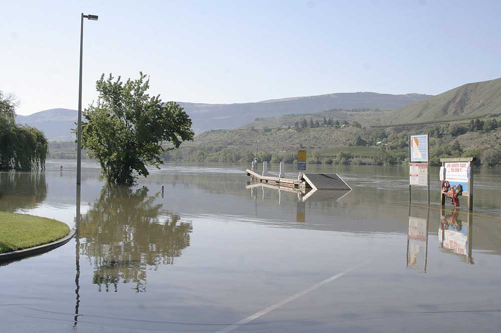
- Kirby Billingsley Hydropark boat launch, south of East Wenatchee, Wash., May 14, is among several area Columbia River boat launches closed by flooding.
OKANOGAN, Wash. — Homes and hundreds if not thousands of acres of pastures, hay fields and orchards along the Okanogan River are inundated by the worst flooding since 1972.
Trending
Warm temperatures causing rapid snowmelt in high country of the North Cascades and Canadian mountains are flooding the Okanogan River from the Canadian border to its confluence into the Columbia River north of Brewster.
Flooding is impacting Okanogan, Ferry, Pend Oreille, Chelan and Douglas counties. Gov. Jay Inslee declared a state of emergency in several counties.
About 50 homes are on standby to evacuate downstream of an old dam high in the Alpine Wilderness above Leavenworth west of Wenatchee. High water could overrun the dam.
Trending
Likewise, an earthen berm near the village of Lost River, near Mazama in the North Cascades, also is threatened and could flood several recreational houses, said Jim DeTro, Okanogan county commissioner.
The berm is damaged and if it fails could quickly flood homes, said the National Weather Service which issued flood warnings for many regional rivers and streams until May 18 and a flash flood watch until May 25.
Basements of some homes along Highway 97, running north-south in the Okanogan Valley, are flooded and water is in small parts of some towns, DeTro said.
“There’s some damage but nothing catastrophic and if we are lucky and the weather is right, we could make it,” he said.
Temperatures into the 90s are expected to bring a peak of just over 21 feet of water on the Okanogan River at Tonasket on May 19 and 20. The record is 22.54 feet and 44,700 cubic feet per second on June 2, 1972.
The river at Tonasket passed flood stage of 15 feet on May 5 and the 18-foot major flood stage mark on May 9.
Tanya Craig, Okanogan County risk manager, said more pastures and hay fields, than orchards, are flooded in the Okanogan Valley. Hay fields are losing first-cuttings, pastures are being damaged and if fruit trees remain under water too long their roots will die from lack of air, officials and fieldmen said.
Dikes built around towns after the 1972 flood are being reinforced with sand bags. Local firefighters and more than 100 firefighters from the state Department of Natural Resources were helping fill and place sand bags.
It could be a matter of weeks before waters recede, Craig said.
Jay O’Brien, manager of the Oroville-Tonasket Irrigation District, said the district has suffered no ill effects but that growers may have had to remove irrigation pumps to prevent them from being flooded.
Karen Moore, Tonasket, posted 147 aerial photos on Facebook from a flight she and her husband took on May 12.
DeTro guesstimated more than 1,000 acres of pasture, hay fields and orchards are flooded and an unknown number of homes and buildings. No serious infrastructure damaged had occurred yet, he said.
Some people evacuated their homes but no official evacuation notices had been issued, he said. There were several road closures due to water over roadways.
The situation is helped, he said, by a 4,000-foot-elevation freezing level at night.
Residents along the Okanogan, Similkameen and Methow rivers and adjacent smaller streams should remain vigilant through the weekend, the Okanogan County Department of Emergency Management advised on its Facebook page.


-
eEdition
-

-
